Property Record
1575 Newton Bridge Rd, Athens, GA 30607
NEARBY LISTINGS FOR SALE OR LEASE
Property Detail
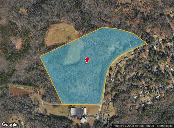
1575 Newton Bridge Rd
Athens-Clarke County, GA
Peterson
102-004
DEEDED ACS: 49.000
Privatepreserveopenspacevacantlandforestlandconservation
Clarke
X
Georgia
13059C0006E
49 AC
2025
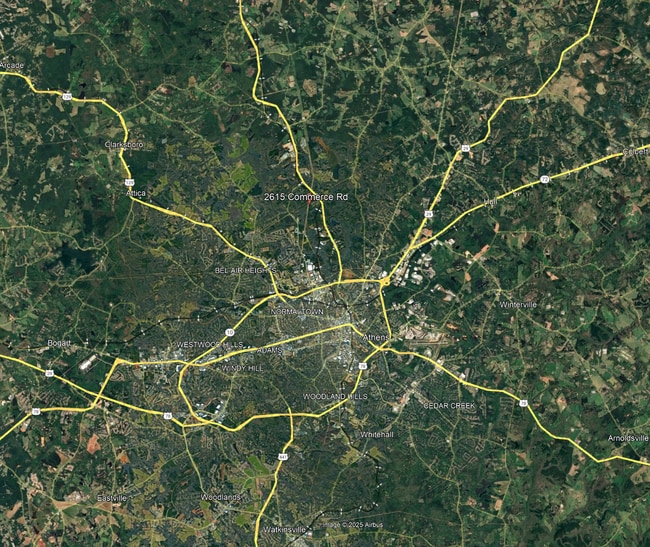
North Athens
2025
Other Market Areas
010602
DEMOGRAPHICS near 1575 Newton Bridge Rd
1 Mile
3 Mile
5 Mile
2024 Total Population
406
10,695
53,328
2029 Population
415
11,108
54,634
Pop Growth 2024-2029
+ 2.22%
+ 3.86%
+ 2.45%
Average Age
38
37
35
2024 Total Households
162
3,827
21,056
HH Growth 2024-2029
+ 1.85%
+ 4.00%
+ 2.21%
Median Household Inc
$43,437
$49,698
$46,757
Avg Household Size
2.40
2.70
2.40
2024 Avg HH Vehicles
2.00
2.00
2.00
Median Home Value
$171,249
$201,335
$223,459
Median Year Built
1981
1987
1985
Nearby Places
Map Layers
Map Styles
 Street
 Aerial
- Restaurants
- Banks
- Shops
- Fitness
- Groceries
SALE & LEASE HISTORY
LISTING DATE
SALE/LEASE

Jan 28, 2025
For Sale
Jan 23, 2025
For Sale
Feb 12, 2019
For Sale
Nearby Properties
Address
Land Use
TOTAL SIZE
Lot Size
Zoning
Address
Land Use
TOTAL SIZE
Lot Size
Zoning
112,071 SF
5.27 AC
E-O
Address
Land Use
TOTAL SIZE
Lot Size
Zoning
77,919 SF
8 AC
E-I
Address
Land Use
TOTAL SIZE
Lot Size
Zoning
58,706 SF
12.86 AC
C-G
Address
Land Use
TOTAL SIZE
Lot Size
Zoning
664,513 SF
84.46 AC
I
Address
Land Use
TOTAL SIZE
Lot Size
Zoning
106,760 SF
10.38 AC
E-O
Address
Land Use
TOTAL SIZE
Lot Size
Zoning
1,378 SF
21.13 AC
RM-1
Address
Land Use
TOTAL SIZE
Lot Size
Zoning
62,856 SF
37 AC
I
Address
Land Use
TOTAL SIZE
Lot Size
Zoning
50,400 SF
3.29 AC
C-G
Address
Land Use
TOTAL SIZE
Lot Size
Zoning
129,424 SF
109.82 AC
I
Address
Land Use
TOTAL SIZE
Lot Size
Zoning
262,400 SF
222.46 AC
GI
Address
Land Use
TOTAL SIZE
Lot Size
Zoning
161,439 SF
10.56 AC
I
Address
Land Use
TOTAL SIZE
Lot Size
Zoning
7,500 SF
280.85 AC
001
Address
Land Use
TOTAL SIZE
Lot Size
Zoning
24,210 SF
0.39 AC
E-I
Address
Land Use
TOTAL SIZE
Lot Size
Zoning
24,500 SF
34.72 AC
AR
Address
Land Use
TOTAL SIZE
Lot Size
Zoning
47,480 SF
9.54 AC
G
Address
Land Use
TOTAL SIZE
Lot Size
Zoning
13,743 SF
2.40 AC
E-I
Address
Land Use
TOTAL SIZE
Lot Size
Zoning
2,592 SF
24.01 AC
G
Address
Land Use
TOTAL SIZE
Lot Size
Zoning
18,158 SF
0.30 AC
E-I
Address
Land Use
TOTAL SIZE
Lot Size
Zoning
39,476 SF
9.52 AC
I
Address
Land Use
TOTAL SIZE
Lot Size
Zoning
21,602 SF
3.50 AC
G
Address
Land Use
TOTAL SIZE
Lot Size
Zoning
16,032 SF
0.25 AC
E-I
Address
Land Use
TOTAL SIZE
Lot Size
Zoning
46.28 AC
RS-8
Address
Land Use
TOTAL SIZE
Lot Size
Zoning
22.18 AC
C-G
Address
Land Use
TOTAL SIZE
Lot Size
Zoning
4,606 SF
1.30 AC
C-G
Address
Land Use
TOTAL SIZE
Lot Size
Zoning
47,176 SF
3.47 AC
I (PD)
Address
Land Use
TOTAL SIZE
Lot Size
Zoning
3,000 SF
7.24 AC
I
Address
Land Use
TOTAL SIZE
Lot Size
Zoning
8,228 SF
4.93 AC
RM-1
Address
Land Use
TOTAL SIZE
Lot Size
Zoning
5,838 SF
3.11 AC
C-G
Address
Land Use
TOTAL SIZE
Lot Size
Zoning
8,228 SF
4.81 AC
RM-1
Address
Land Use
TOTAL SIZE
Lot Size
Zoning
374.29 AC
001
The World's #1 Commercial Real Estate Marketplace
Connect with us
© 2025 CoStar Group
The information above has been obtained from sources believed reliable. While we do not doubt its accuracy we have not verified it and make no guarantee, warranty or representation about it. It is your responsibility to independently confirm its accuracy and completeness. Any projections, opinions, assumptions, or estimates used are for example only and do not represent the current or future performance of the property. The value of this transaction to you depends on tax and other factors which should be evaluated by your tax, financial, and legal advisors. You and your advisors should conduct a careful, independent investigation of the property to determine to your satisfaction the suitability of the property for your needs.